
Route Overview
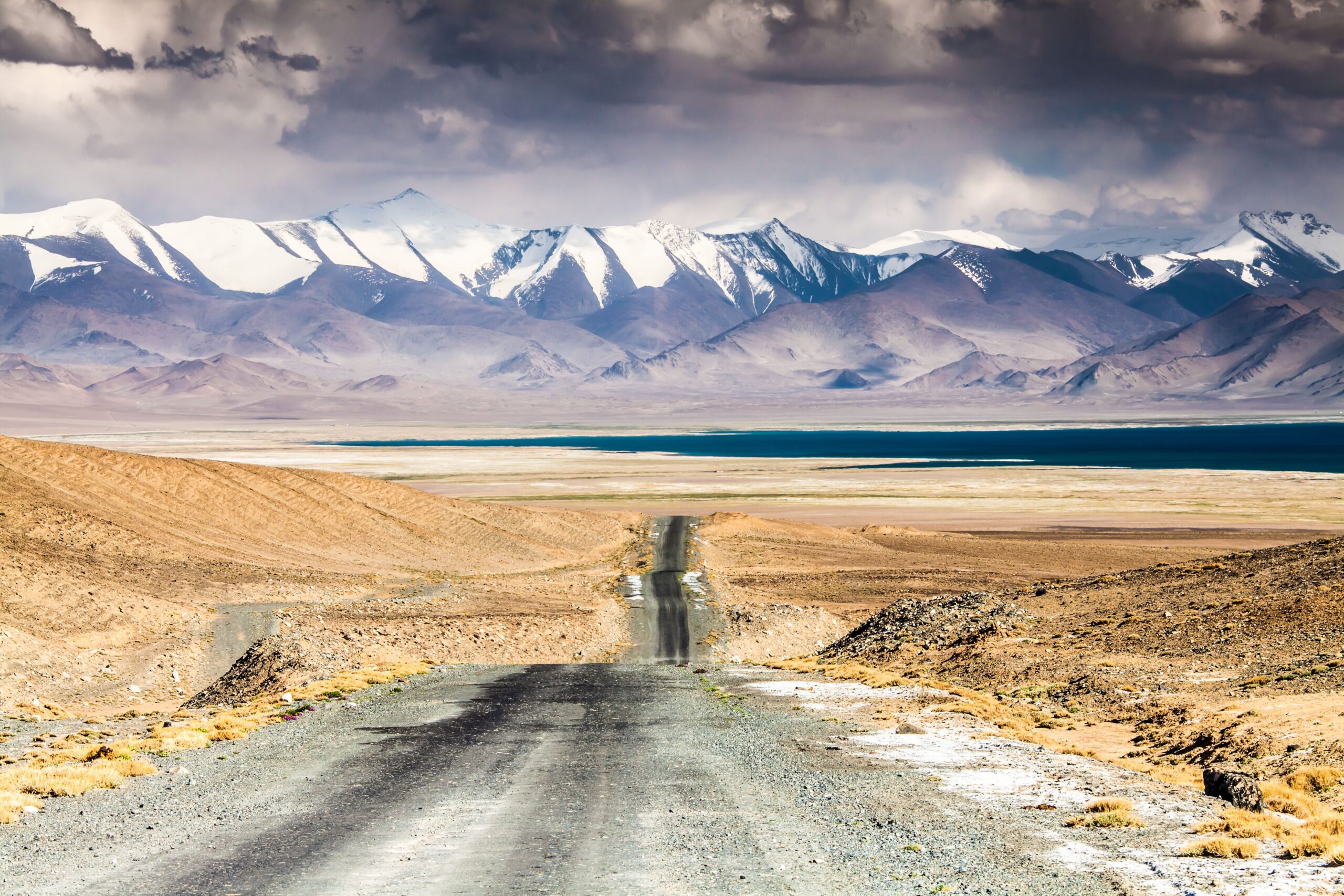
The Pamir Highway is the M41, the road from Dushanbe through the Gorno-Badakhshan Autonomous Oblast (GBAO) to Osh in Kyrgyzstan, roughly 1,250 km depending on the route you take. It crosses the Ak-Baital Pass at 4,655 metres, the second-highest point of any international highway after the Karakoram Highway between Pakistan and China. Most travellers hire a driver and 4x4 for 7 to 10 days; a longer trip with rest days is easier on the body at this altitude.
It suits travellers who are comfortable with rough roads, long driving days and basic homestays. This is not a self-drive road trip in the usual sense: self-drive rentals exist but are uncommon, and the road conditions reward local experience, so the standard way is a driver and 4x4 arranged in Dushanbe or Khorog, usually split among a small group.
Two things need sorting before you book anything: the GBAO permit, which is required for the Pamir Highway and is added to your eVisa application, and the season. Passes above 4,000 metres are reliably open only from June to September, and snow can close the route entirely outside that window.
The Itinerary
Permits, Cash and a Driver
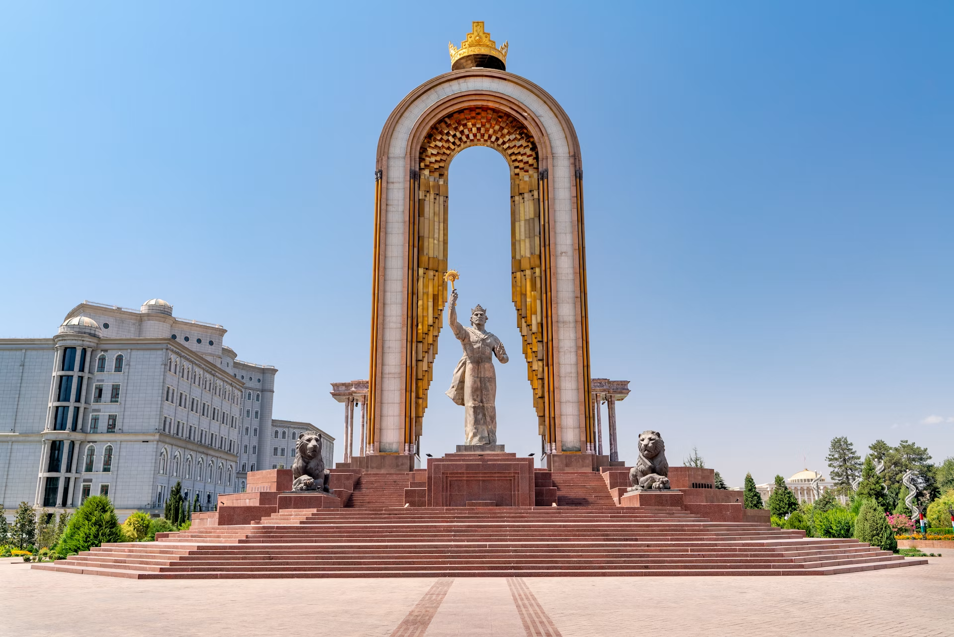
Dushanbe is where the trip is arranged. Apply for the eVisa and add the GBAO permit to the same application if you have not already, then book a driver and 4x4 through a Dushanbe or Khorog agency. Dushanbe hostels such as Green House Hostel and Topchan Hostel specialise in helping travellers plan Pamir Highway logistics, drivers and permits.
Bring more cash than you think you need, in US dollars. ATMs are reliable in Dushanbe and Khorog and sparse to nonexistent elsewhere. Download offline maps before you leave the capital, because signal in the Pamirs is patchy to nonexistent.
- Hostels and agencies - Green House Hostel and Topchan Hostel help with drivers, permits and group-splitting.
- Cash - Exchange US dollars at a bank and carry small somoni notes for homestays and markets.
Into GBAO and Along the Afghan Border
Khorog, the GBAO capital, sits in a green river valley and feels like a different country from Dushanbe: a strong Ismaili Muslim culture, an Aga Khan-funded university campus and a relaxed, leafy town square. You can reach it overland with your driver or fly Dushanbe to Khorog for about $50-70, but the flight is weather-dependent and frequently cancelled or delayed, so never book a tight connection around it.
From Khorog the Wakhan Valley runs along the Afghan border. The fortresses at Yamchun and Kah Kaha date from the Silk Road era, and the Bibi Fatima hot springs above the valley near Vrang are a welcome stop after days of rough road. Do not photograph military checkpoints or border installations, particularly near the Afghan border.
- Khorog - Aga Khan-funded university campus, leafy square, guesthouses aimed at Pamir Highway travellers.
- Yamchun and Kah Kaha - Silk Road-era fortresses looking across the river into Afghanistan.
- Bibi Fatima hot springs - Natural thermal spring above the Wakhan Valley near Vrang.
The High Plateau
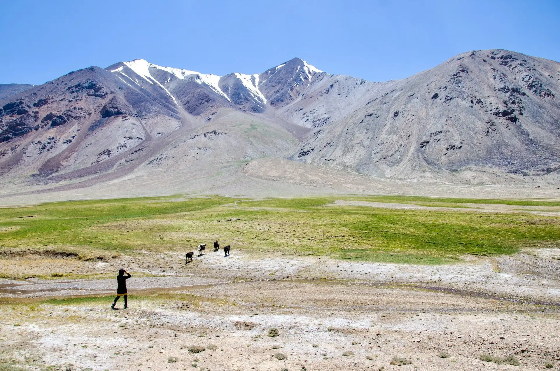
This is the stretch that earns the highway its reputation. The road climbs onto the high plateau to Murghab, the highest town on the route at nearly 3,600 metres, where nights can fall below zero even in summer. Build in acclimatisation time instead of racing straight up, and know the symptoms of altitude sickness before you go.
Passes above 4,000 metres are reliably open only from June to September. Outside that window, snow can close the route entirely.
- Murghab - The highest town on the route, at nearly 3,600 metres. Cold nights even in summer.
- Acclimatisation - Build in rest days instead of racing straight up, and know the symptoms of altitude sickness.
Ak-Baital, Karakul and the Kyrgyz Border
The final stretch crosses the Ak-Baital Pass at 4,655 metres, the high point of the whole road, and drops to Karakul, a startling turquoise lake in a meteorite crater at nearly 4,000 metres. Basic homestays in Karakul village let you watch the light change over the water at dawn.
From here the road continues over the Kyzyl-Art Pass border crossing into Kyrgyzstan and on to Osh. If you would rather not drive back, you can also fly from Khorog to Dushanbe when the weather allows, leaving a buffer day for cancellations.
- Ak-Baital Pass - 4,655 metres, the second-highest point of any international highway.
- Karakul Lake - Meteorite crater lake at nearly 4,000 metres, best at dawn.
- Kyzyl-Art crossing - Links the end of the Pamir Highway directly to Osh in Kyrgyzstan.
Must-See Locations
Three places define this road. Each is worth the altitude.
Ak-Baital Pass
At 4,655 metres, the high point of the M41 and the second-highest point of any international highway, after the Karakoram Highway.
Wakhan Valley
Silk Road-era fortresses at Yamchun and Kah Kaha look straight across the river into Afghan villages. Bibi Fatima hot springs sit above the valley.
Karakul Lake
A turquoise lake filling a meteorite impact crater at nearly 4,000 metres, ringed by Pamir peaks. One of the highway's quiet highlights.
Driving & Roads
The Pamir Highway is long, high and often rough, but the real variables are altitude, season and paperwork. The road is being steadily upgraded with Chinese and World Bank financing, yet unpaved stretches remain.
4x4 with a Driver
The standard way to do the highway. A hired 4x4 with driver costs about $80-150 a day and is usually split among a group. Self-drive rentals exist but are uncommon.
Road Conditions
Expect unpaved stretches and slow progress. Distance is deceptive: on mountain roads a map inch can be a full day's drive.
Cash and ATMs
ATMs are reliable in Dushanbe and Khorog, sparse to nonexistent elsewhere. Bring US dollars to exchange and small somoni notes for homestays and markets.
Mountain Passes
Passes above 4,000 metres are reliably open only from June to September. Snow can close the route entirely outside that window.
Navigation and Signal
Download offline maps before heading into the Pamirs, where signal is patchy to nonexistent. An eSIM covers Dushanbe well but will not help much past Khorog.
Checkpoints
Checkpoints on the highway check the GBAO permit. Do not photograph government buildings, military checkpoints or border installations.
Essential Tips
🌞 Best Season
June to September is the only reliable window for the high passes. July and August are peak season for Pamir Highway bookings. From November to March, avoid the Pamirs: the high passes are closed by snow.
🏨 Accommodation
Pamir homestays cost about $10-20 a night including dinner and breakfast, and are often the only option outside the main towns. Khorog has a small but growing set of family-run guesthouses, usually arranged through a local agency.
📝 Visa and GBAO Permit
Nearly everyone needs an eVisa from evisa.tj: $30 for single entry (45-day stay) or $50 for multiple entry, approved in about 72 hours. Add the GBAO permit, roughly $20, to the same application. It is an endorsement on the eVisa, not a separate document, and authorities have suspended it on short notice in past years.
🛡 Safety
Most of Tajikistan is safe with normal precautions, but GBAO carries a higher official advisory than the rest of the country. Check the current US and UK advisories before you commit dates, and get travel insurance that covers high altitude and emergency evacuation.
🍅 Food
Expect plov, qurutob and shashlik, skewered charcoal-grilled meat at about $3-6, and sambusa pastries at about $0.50 each. Homestay dinners are often made from the household's own supplies.
👜 Culture and Dress
The Pamir region is predominantly Ismaili, followers of the Aga Khan. Accept tea and food when offered, and dress modestly: shoulders and knees covered for both men and women in rural areas and the Pamirs.
Pamir Highway FAQ
How long does the Pamir Highway take?
Most travellers hire a driver and 4x4 for 7 to 10 days. A longer trip with rest days for altitude and the Wakhan Valley is easier on the body.
Where does the Pamir Highway start and end?
The M41 runs from Dushanbe in Tajikistan through the Gorno-Badakhshan Autonomous Oblast to Osh in Kyrgyzstan, roughly 1,250 km depending on the route.
Do I need a permit for the Pamir Highway?
Yes. You need the GBAO permit, roughly $20, for the Pamir Highway and anywhere in Gorno-Badakhshan. Add it to your eVisa application at evisa.tj. Checkpoints on the highway check it, and authorities have suspended it on short notice in past years.
Is the Pamir Highway safe?
Most of Tajikistan is safe with normal precautions, but GBAO carries a higher official advisory than the rest of the country. Check the current US and UK advisories before you commit dates, bring travel insurance that covers high altitude and evacuation, and do not photograph military checkpoints or border installations.
When is the best time to drive the Pamir Highway?
June to September. Passes above 4,000 metres are reliably open only in that window, and snow can close the route entirely at other times.
How high is the Pamir Highway?
The Ak-Baital Pass reaches 4,655 metres, the second-highest point of any international highway after the Karakoram Highway between Pakistan and China. Murghab, the highest town on the route, sits at nearly 3,600 metres.
Can I self-drive the Pamir Highway?
Self-drive rentals exist but are uncommon, and the road conditions reward local experience. Most travellers hire a driver and 4x4 in Dushanbe or Khorog.
How much does the Pamir Highway cost?
A hired 4x4 with driver costs about $80-150 a day, usually split among a group. Homestays are about $10-20 a night including dinner, the eVisa is $30, and the GBAO permit is roughly $20.
Budget Planning
Tajikistan is one of the more affordable countries in Asia for day-to-day costs. A Pamir Highway trip has one unavoidable line item: a hired driver and vehicle, which most travellers split among a small group.
Book Your Trip
Everything in one place. These are services worth actually using.
A Road You Plan For, Then Never Forget
The Pamir Highway rewards preparation. The permit, the season, the altitude and the cash all need sorting before you leave Dushanbe, and the rough road asks for patience. In return you get the second-highest international highway on earth, Silk Road fortresses across the river from Afghanistan, and homestay dinners cooked from the household's own supplies.
Read the full Tajikistan guide before you commit dates, because GBAO carries a higher advisory than the rest of the country and the permit can change at short notice.