
Patagonia
Route 40
Bariloche to Punta Arenas through the most remote, windswept, and unreasonably beautiful landscapes on earth. Fitz Roy, Perito Moreno, Torres del Paine, and 2,400 km of gravel road that makes you feel like the last person alive.
Route Overview
Patagonia is not a place that cares whether you came. The wind blows at speeds that make standing upright an act of stubbornness. The distances between fuel stations are measured in the hundreds of kilometres. The gravel road that Argentina calls Ruta Nacional 40 stretches south through a steppe so empty that the guanacos outnumber the humans by a factor that nobody has bothered to calculate. And at the end of it, or rather at several points along the way, the landscape does things so extraordinary that you stop questioning why you drove eight hours on a road that shook your fillings loose.
Fitz Roy appears above El Chalten like a granite hallucination: jagged spires rising to 3,405 metres, often hidden by cloud and then revealed all at once in a way that makes experienced hikers stop mid-step. Perito Moreno Glacier is a wall of blue ice five kilometres wide and sixty metres tall that calves house-sized chunks into turquoise water with a sound like cannon fire. Torres del Paine, across the border in Chile, puts three granite towers above a landscape of lakes, forests, and glaciers that is so complete it feels designed. These are not exaggerations. They are understatements. Patagonia is like that.
This is not a comfortable roadtrip. It is a magnificent one. The roads are partly paved and partly gravel. The weather changes four times in an hour. The wind is a character in the trip, not a feature of it. Services are sparse. Cell coverage disappears for days at a time. You will carry extra fuel, extra water, extra food, and a spare tyre you genuinely hope you won't need. And you will come back describing it as the best drive you've ever done, because it is.
The Itinerary

The Lake District Gateway
San Carlos de Bariloche is Argentina's alpine town: Swiss-style architecture on Lake Nahuel Huapi with the Andes behind it, and a chocolate industry that takes itself as seriously as the Swiss take theirs. The Circuito Chico is a sixty-kilometre scenic loop around the lake that passes the Llao Llao Hotel (one of South America's most famous, worth a coffee even if you can't afford the room), forest viewpoints, and beaches where the water is clear and bracingly cold. Cerro Campanario's chairlift gives what locals claim is the best panoramic view in the region; the claim is reasonable.
This is your last comfortable base before the steppe. Pick up your rental car (high-clearance, ideally 4x4), stock up on supplies, buy a jerry can for extra fuel, and enjoy the restaurants and craft breweries. Bariloche's chocolate shops (Rapa Nui, Mamuschka, Fenoglio) are a cultural institution. The craft beer scene, anchored by Cerveceria Patagonia, is excellent. Eat well. The food options decrease significantly once you head south.
- Circuito Chico - 60 km scenic loop. Llao Llao Hotel, lake viewpoints, forest beaches. Half-day drive.
- Cerro Campanario - Chairlift to panoramic views over seven lakes. Best viewpoint in the area.
- Chocolate shops - Rapa Nui, Mamuschka, Fenoglio. Bariloche's claim to fame after the lakes.
- Supplies - Fill fuel, buy jerry can, stock food/water. Last major supply point before the steppe.
The Steppe
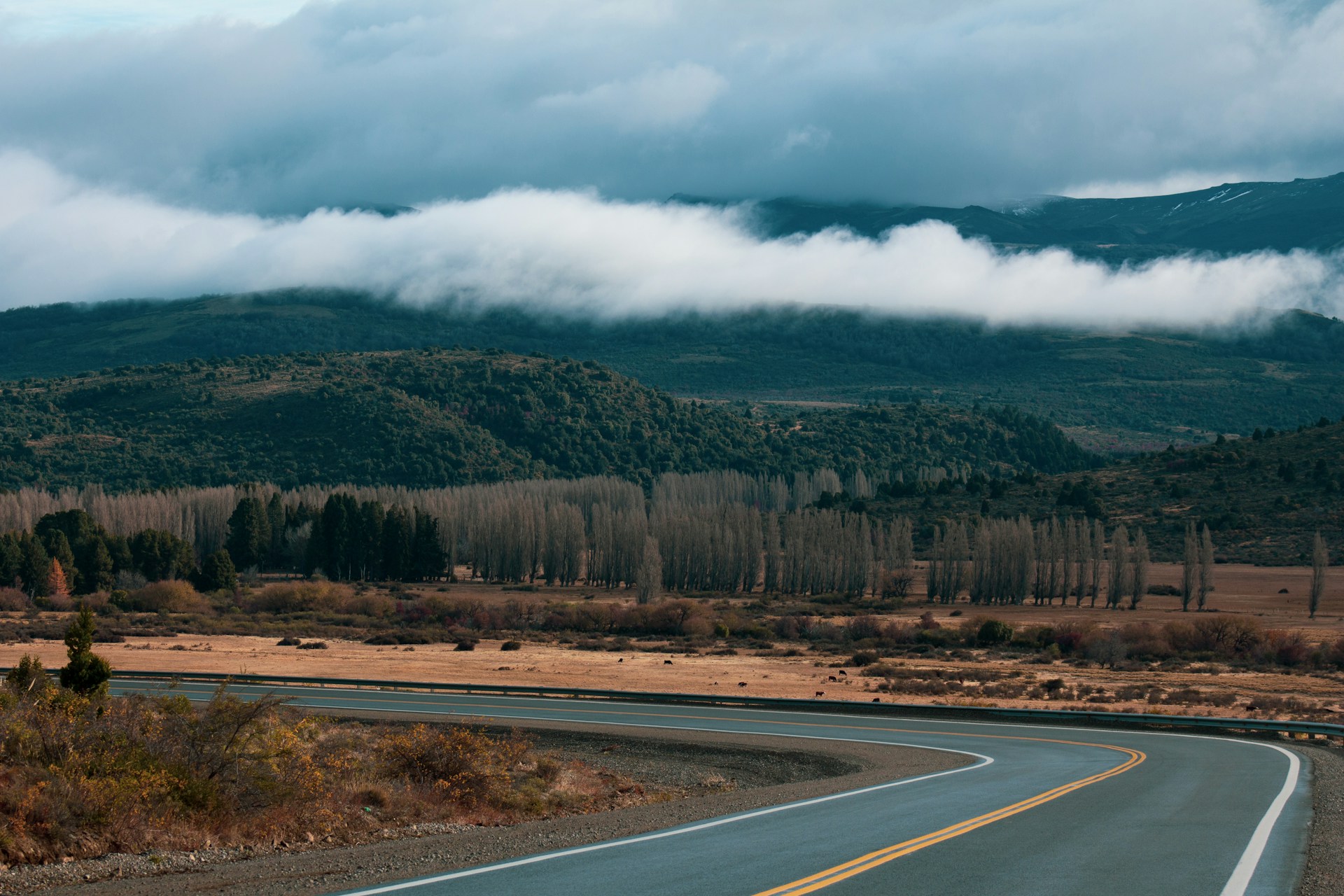
This is where Patagonia stops being picturesque and starts being Patagonia. Route 40 south of Bariloche alternates between paved sections and ripio (gravel) that shakes through the chassis and makes 60 km/h feel fast. The landscape is vast, empty steppe: brown grassland stretching to the horizon in every direction, punctuated by guanacos standing in the middle of the road with the calm indifference of animals that have nowhere to be.
Stop in Esquel (gateway to Los Alerces National Park, where ancient alerce trees, some over 2,600 years old, grow near turquoise lakes). Continue south through the steppe, overnighting in Perito Moreno town (not the glacier; the town is named after the same explorer but is 500 km north of the ice). Reach Los Antiguos on the shore of Lago Buenos Aires/General Carrera (second-largest lake in South America, shared with Chile). The optional detour to Cueva de las Manos (Cave of Hands) brings you to 9,000-year-old handprint paintings on a canyon wall. Fill fuel at every station. Some stretches have no fuel for 300 km.
- Los Alerces National Park - Ancient alerce trees (2,600+ years old), turquoise lakes. Detour from Esquel.
- Route 40 ripio - The iconic gravel road. Empty steppe, big sky, guanacos. Fill fuel at every opportunity.
- Cueva de las Manos - 9,000-year-old handprint cave art. UNESCO site. Detour off Route 40.
- Los Antiguos - Cherry capital on Lago Buenos Aires. Mild microclimate. Last easy stop before El Chalten.

Argentina's Trekking Capital
El Chalten was founded in 1985 for geopolitical reasons (Argentina wanted to establish a presence near the Chilean border) and has since become the trekking capital of the country, which is a significant upgrade in purpose. The town sits beneath Mount Fitz Roy and Cerro Torre, two of the most dramatic peaks in the Andes, and the hiking that starts from the edge of town is world-class.
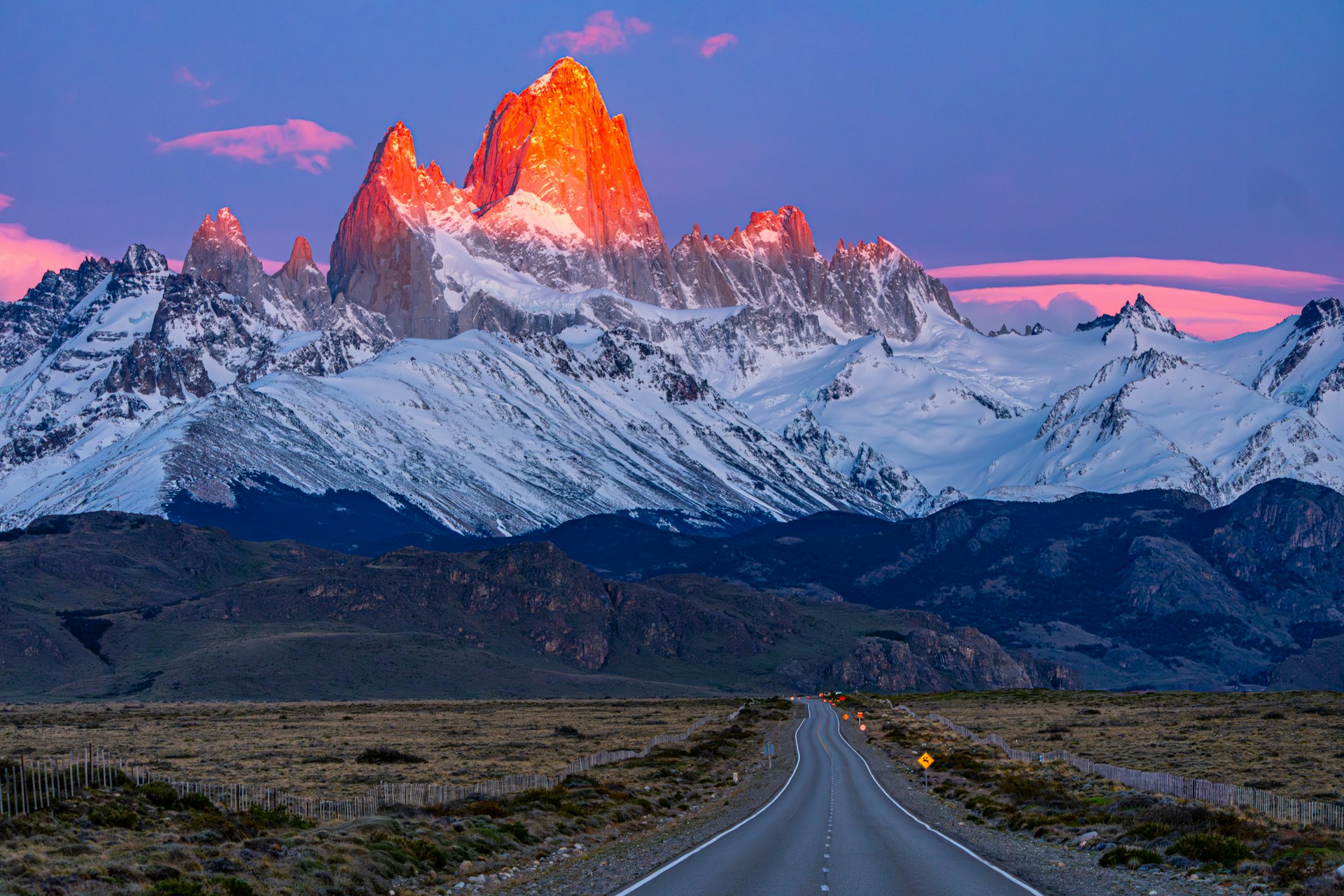
The essential hike: Laguna de los Tres. Eight to ten hours return, steep, demanding, and worth every burning quadricep. Start before dawn to arrive at the lake for sunrise, when Fitz Roy's granite towers turn pink and then gold above a glacial lake that reflects them with an accuracy that feels intentional. Bring layers (the summit is exposed and cold even in summer), food, and two litres of water. Laguna Torre (six to eight hours, slightly easier) gives views of Cerro Torre's impossibly thin spire. Laguna Capri is the shorter option (four hours) with Fitz Roy views that reward less effort. The town has surprisingly good restaurants, brewpubs, and a young outdoorsy energy. Weather changes by the minute. Pack for everything.
- Laguna de los Tres - The sunrise hike. 8-10 hrs, hard. Fitz Roy reflected in glacial lake at dawn. The moment of the trip.
- Laguna Torre - Cerro Torre views. 6-8 hrs, moderate. Glacier at the end. Less crowded than Laguna de los Tres.
- Laguna Capri - Shorter Fitz Roy views. 4 hrs, moderate. Good option if weather limits your main hike.
- El Chalten town - Brewpubs, gear shops, restaurants. La Cerveceria for craft beer. Patagonia vibe at its best.

The Glacier That Thunders
El Calafate is the tourist town on Lago Argentino that exists because Perito Moreno Glacier exists. The town itself is functional rather than charming, but the glacier is extraordinary in a way that the word extraordinary doesn't quite cover.
Perito Moreno is five kilometres wide and sixty metres tall at the face. It is one of the few glaciers in the world that is still advancing. The boardwalks bring you within metres of the ice wall, close enough to hear the deep cracks and groans that precede a calving event, where a chunk of ice the size of a building breaks away from the face and crashes into the turquoise water below. The sound is like thunder. The splash sends waves to the opposite shore. You can spend an hour here or a full day; either way, you will stand and watch and wait for the next one. The Big Ice trek (book ahead, full day) puts crampons on your feet and walks you onto the glacier itself. Optional boat tours to Upsala and Spegazzini glaciers offer different perspectives and are worth the full day if you have time.
- Perito Moreno Glacier - Boardwalk viewing. 5 km wide, 60m tall. Ice calving into turquoise water. ~$30 park entry.
- Big Ice trek - Walk on the glacier with crampons. Full day. Book months ahead in peak season. ~$200.
- Upsala + Spegazzini boat tour - Full-day boat trip to other glaciers. Different perspectives. ~$150.
- Glaciarium - Glacier museum with an ice bar (drinks served in ice glasses). Informative and fun.

Chile's Crown Jewel
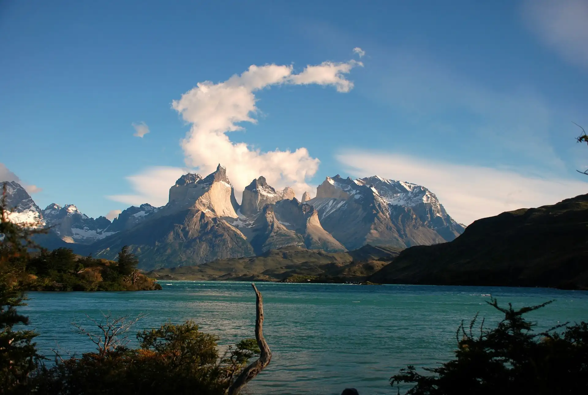
Cross into Chile (the border crossing takes thirty to sixty minutes; ensure your rental agreement covers Chile) and drive to Torres del Paine National Park, which is exactly as spectacular as its reputation. The park contains the three granite towers (the Torres), the Cuernos del Paine (horns), Grey Glacier, lakes of improbable blue, and guanacos grazing with the mountains behind them in a composition so perfect it looks staged.
Day hikes from the road: Base Las Torres (eight to nine hours, steep, the iconic view of the three towers reflected in the lake at the top, worth every step and every ache the next day). French Valley (eight hours, a granite amphitheatre that makes human scale feel irrelevant). Grey Glacier viewpoint (six hours, easier, glacier and icebergs in the lake). For multi-day hikers, the W Trek (four to five days, refugios or camping) covers all three valleys and is one of the great trek routes on earth. Book refugios a year ahead for peak season. The park circuit road gives views and wildlife even without hiking. Pumas are present (sightings are rare but increasing). Stay at campsites, refugios inside the park, or in Puerto Natales (the gateway town, ninety minutes away).
- Base Las Torres - The iconic view. 8-9 hrs, hard. Three granite towers above a glacial lake. Start at dawn.
- French Valley - Granite amphitheatre. 8 hrs, moderate-hard. One of the most dramatic valleys in the Andes.
- Grey Glacier - Glacier and icebergs. 6 hrs, moderate. The most accessible of the three main hikes.
- Park circuit drive - Guanacos, lake views, Cuernos del Paine. Spectacular even from the car. ~$30 park entry.

The End of the World
Drive south to Punta Arenas on the Strait of Magellan, Chile's southernmost major city and the endpoint of this trip. The city was once a critical stop for ships rounding Cape Horn, and the streets still have the architecture and energy of a port town that has been receiving people from the other end of the world for centuries.
The Nao Victoria Museum has a full-scale replica of Magellan's ship, which is small enough to make you question the sanity of anyone who sailed it around the world. The municipal cemetery is genuinely beautiful: elaborate mausoleums of early European settlers alongside memorials to the indigenous Selk'nam people. The Isla Magdalena penguin colony (seasonal boat tour, October to March) puts you among 60,000 Magellanic penguins who regard you with the polite disinterest of locals who've seen tourists before. Eat centolla (king crab) at a waterfront restaurant. Return your car. Fly home from the bottom of the world having driven one of the greatest and most demanding roadtrips on earth.
- Isla Magdalena - 60,000 Magellanic penguins. Boat tour, seasonal (Oct-Mar). Book ahead. ~$60.
- Nao Victoria Museum - Replica of Magellan's ship. Makes you grateful for modern transport.
- Municipal Cemetery - Beautiful and historically significant. Mausoleums, cypress avenues, Selk'nam memorials.
- Centolla (King Crab) - Patagonian speciality. Fresh, enormous, and the correct way to end this trip.
Must-See Locations
Three places on this route redefine what you thought landscapes could do. You'll try to show people the photographs and they'll think you edited them.
Fitz Roy at Sunrise
The granite spires turn pink, then gold, then white as the sun rises behind you. The glacial lake reflects every colour. You stand at 1,200m after a pre-dawn hike and forget that your legs exist.

Perito Moreno Calving
A wall of blue ice the height of a twenty-storey building. A crack like rifle fire. A chunk the size of a house falls into turquoise water. The wave hits the far shore. You stand and wait for it to happen again.

Base Las Torres
Three granite towers above a glacial lake at the end of a nine-hour hike. The moment you crest the final moraine and see them is the moment this trip justifies itself entirely.
Driving & Ripio
Driving in Patagonia is unlike driving anywhere else. The wind alone is a factor that changes how you drive, park, and open your door. The gravel roads (ripio) require a different approach from tarmac. The remoteness means self-sufficiency is not optional. This section is not meant to discourage you. It's meant to prepare you.
Vehicle
High-clearance SUV or 4x4 strongly recommended. Large sections of Route 40 are unpaved ripio (gravel, loose stones, washboard). A standard sedan can technically survive but a 4x4 is significantly safer and more comfortable. Carry two spare tyres. Check the tyres before you leave Bariloche.
The Wind
Patagonian wind is not normal wind. Sustained speeds of 80-100 km/h are common. Gusts can physically move a car. Open doors carefully (the wind will rip them from the hinges). Park facing into the wind. Drive slowly when gusting. This is not exaggeration.
Fuel
Fill up at every station. Between Bariloche and El Chalten, stretches of 200-300 km have no fuel. Carry a jerry can (20 litres minimum). Fuel is more expensive in remote areas. YPF stations are the most common. Always check the gauge before leaving a town.
Ripio (Gravel)
Drive at 40-60 km/h maximum on ripio. Loose stones cause punctures and loss of control at speed. Washboard sections vibrate everything loose. Keep a safe distance from vehicles ahead (stone spray). Slow down for oncoming vehicles. Your rental insurance may not cover ripio damage.
Border Crossing
El Calafate to Torres del Paine crosses the Argentina-Chile border. Not all rental companies allow border crossings (check before booking, pay the fee). Bring vehicle documents, passport, and rental agreement. The crossing takes 30-60 minutes. No fresh food across the border.
Remoteness
No cell service for most of the steppe. Download offline maps. Carry physical road maps as backup. Tell someone your itinerary and expected arrival times. Carry food, water (minimum 5 litres), warm clothing, and a first aid kit. Other vehicles are your only roadside assistance.
Essential Tips
🌞 Season
November to March only. December to February is peak: longest days (17+ hours of daylight), best weather, highest prices. November and March are excellent shoulder months with fewer hikers. April to October most roads close, services shut down, and many towns essentially hibernate. Torres del Paine refugios book out a year ahead for January.
🏨 Accommodation
Book El Chalten, El Calafate, and Torres del Paine months ahead for December-February. Mix hotels, hostels, and campsites. Torres del Paine refugios (mountain huts) require booking up to a year in advance for peak W Trek season. Puerto Natales is a cheaper base than staying inside the park. Wild camping is prohibited in national parks.
🌬 Weather
Four seasons in one hour is a local saying because it's accurate. Sun, wind, rain, and sleet can all happen in a single hike. Bring a layering system: base layer, fleece, windproof/waterproof shell. The wind is constant and genuinely fierce. Temperatures range from -5°C to 25°C even in summer. Sunglasses, sunscreen, and a warm hat are all essential simultaneously.
💰 Money
Argentina uses pesos (ARS), Chile uses pesos (CLP). Argentina's exchange rate situation is complex; the "blue dollar" unofficial rate gives significantly more pesos per USD than the official rate. ATMs in small towns have low withdrawal limits and sometimes run out of cash. Bring US dollars as backup. Cards work in tourist towns but not on the steppe.
🍖 Food
Patagonian lamb (cordero patagonico) slow-roasted over an open fire is the regional dish and it is exceptional. El Chalten and El Calafate have good restaurants. On the steppe, you're eating whatever you packed. Empanadas are available everywhere. Mate (herbal tea) is the social drink. Calafate berries (local legend says eating them means you'll return) appear in ice cream, jam, and beer.
👜 Packing
Layering system (base, fleece, waterproof shell, windproof outer). Warm hat, gloves, buff/neck gaiter. Hiking boots (broken in). Sunscreen + sunglasses. Trekking poles for multi-day hikes. Headlamp. Water bottle + purification. Offline maps downloaded. Cash in both pesos and USD. Patience for the wind.
Budget Planning
Patagonia is not cheap by South American standards, but it's reasonable by global standards for the quality of the experience. Argentina (especially with the blue dollar rate) is significantly cheaper than Chile. The biggest costs are the rental car, fuel (remote areas charge a premium), and Torres del Paine activities/accommodation.
Book Your Trip
Everything in one place.
The Road That Makes Everything Else Feel Small
Patagonia does something to the way you measure things. After Fitz Roy, other mountains seem polite. After Perito Moreno, other glaciers seem like ice cubes. After driving eight hours across empty steppe with the wind trying to push your car into Chile, other "long drives" feel like commutes. The scale here is not human. The mountains were not built for you. The wind doesn't know you're there. The glacier was calving long before anyone stood on the boardwalk and will be calving long after the boardwalk is gone.
But you'll stand at Laguna de los Tres at sunrise, watching Fitz Roy turn pink, and feel something that the internet and its photographs could not have delivered. You'll sit on the boardwalk at Perito Moreno and wait for the next crack, and when it comes, you'll flinch and laugh and wait again. You'll walk to the base of the Torres and look up and understand why people do this. Patagonia is the trip that recalibrates everything. It's also the trip that breaks your windshield, flattens your tyre, and blows your door open. Do it anyway.